No Hardware.
No Software.
This is the software-defined, hardware-free future of navigation.
.png)

Plot Twice / Walk Once

Unlike existing alt-navigation solutions, Plot2x Trek does not require any additional hardware or batteries. All data processing is handled on the end-user device, removing the need for could, GPS or other external connectivity.
Built for commercial, off-the-shelf devices.
Jamming and spoofing are now norms across every domain.
Assets and personnel must operate amidescalating interference.
Navigate without GPS
Plot2x Trek provides assured positioning, navigation and timing on the devices personnel already use and trust the most.

Most solutions don’t solve for all kinds of interference.
Jamming and spoofing are often mitigated in different ways.
Guarantee APNT
Plot2x Trek defeats both jamming, spoofing and interference, delivering assured navigation when it matters most.
Alt PNT solutions are heavy and power hungry.
Hardware-heavy alternatives add weight and increase power consumption, making them impractical for most soldiers and systems.
Use a software-defined solution
Plot2x Trek eliminates the size, weight, power and cost burdens associated with traditional hardware.
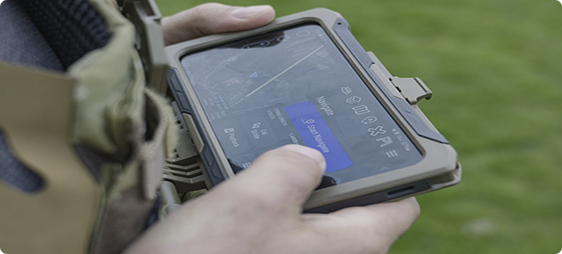
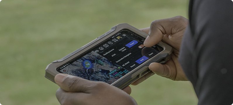
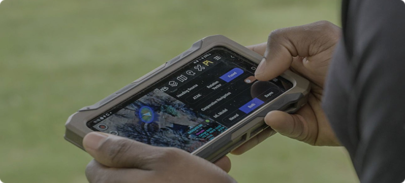
Unlock Rapid Deployment with High Accuracy.
Plot2x Trek integrates with ATAK - the geolocation app trusted by U.S. warfighters and NATO allies.
Battlefield Developed
Proven in field use with ~50 m accuracy, non-compounding error and low power draw.